

BOVEY, Minn. — At 78 years old, Cavour Johnson says his time is limited for maintaining trails through the sprawling pine woods north of Bovey.
When he learned the North Country National Scenic Trail was struggling to find passage through terrain he’s been wandering since childhood, he sought to forge a scenic route that could be folded into something lasting.
ADVERTISEMENT
“I’m a trails guy,” the soft-spoken retired dentist said, stepping between jack pines onto a narrow path. In decades past, Johnson built cross-country ski trails at Mount Itasca in Coleraine and helped develop the Mesabi Trail, the paved bike path spanning 150 miles between Grand Rapids and Ely.
The biting wind this late April morning spurs irreconcilable differences between steely clouds and spring sun, both vying for dominance. Wearing several layers of clothing, Johnson walks the high southern bank over the West Fork of the Prairie River, its bottom of rippled sand visible through water tinted like weak herbal tea. Frantic wood ducks scream at Johnson’s approach, while newly arrived yellow-rumped warblers flit unbothered in alder bushes.
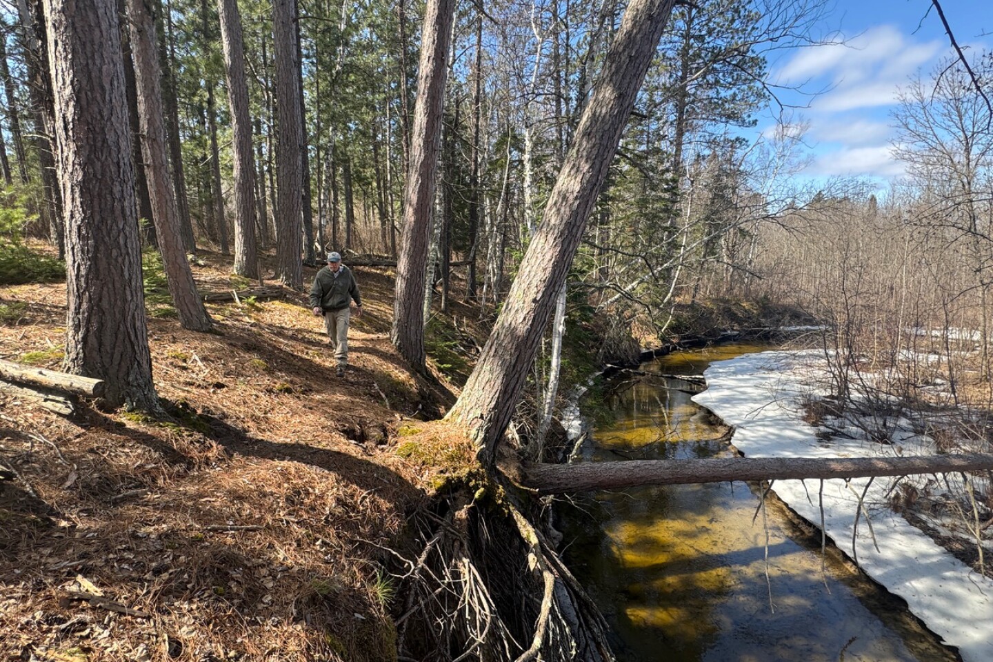
“You don’t see anybody out here,” he said. “It’s like you’re way out in the boonies.”
One could make a strong case that there are no "likes" about it, that this place is most definitely in the boonies.

Meandering 4,800 miles from North Dakota to Vermont, the North Country National Scenic Trail crosses eight states and is the country’s longest such footpath. According to the National Park Service, which oversees National Scenic Trails, these paths are “intended to showcase our country’s spectacular natural resources and beauty ... connect communities, significant landmarks and public lands.”
The NCT was created in 1980 and is still unfinished, but its venerable siblings, the Appalachian and Pacific Crest trails, draw thousands of long-distance hikers every year. The NCT enters Minnesota from the west near Fergus Falls before winding 850 miles through the state. After passing Detroit Lakes, it joins long sections of completed footpath through Itasca State Park and the Chippewa National Forest.
Farther on, from Snowbank Lake, east of Ely, the NCT follows 400 miles of preexisting footpath through the Boundary Waters Canoe Area Wilderness and along the North Shore on a network of the Kekekabic, Border Route and Superior hiking trails, until it traverses Duluth before finally reaching Wisconsin through Jay Cooke State Park.
ADVERTISEMENT
Between Snowbank Lake and the eastern end of the Chippewa National Forest near Grand Rapids, however, lurks a 150-mile section of missing trail, known as The Big Gap.
In 2020, during the pandemic, Johnson cared for someone undergoing medical treatment. To protect that person, whom he doesn’t want named, he socially distanced and found himself cut off from his usual community involvements. He needed to do something to counteract his isolation and caretaking stress. He’d been thinking that the NCT’s proposed route was flawed.
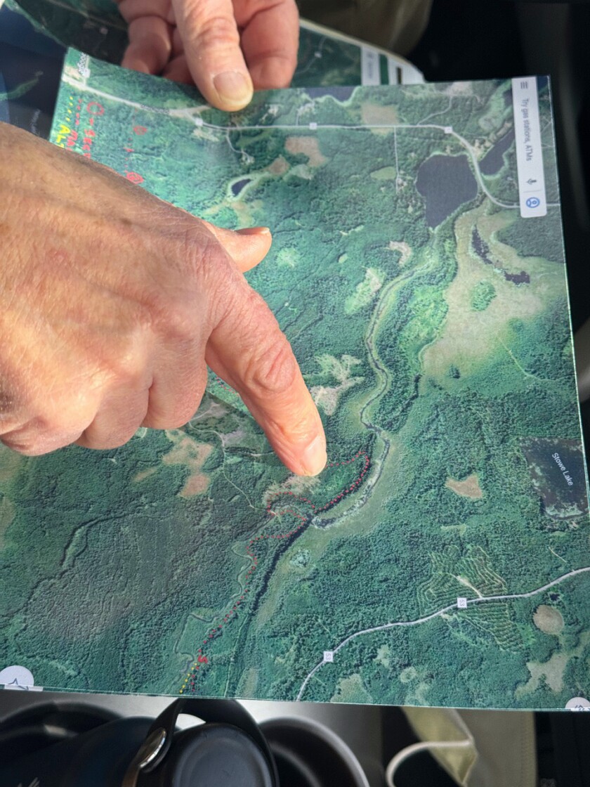
On paper, it ran through a huge swamp surrounding Bear Lake — no way to build a trail there.
He thought he could find a drier crossing just a few miles south that was also prettier and decided to scout a route between Scenic Highway and Minnesota Highway 65, a crow-flight of 8 miles through country he knew well. His parents had bought land here in the early 1950s, and he still owns 40 acres on Hartley Lake, a wide spot on the West Fork of the Prairie River.
I’ve gone into this thinking I might not be around to see the development happen, but am satisfied that I’m contributing.
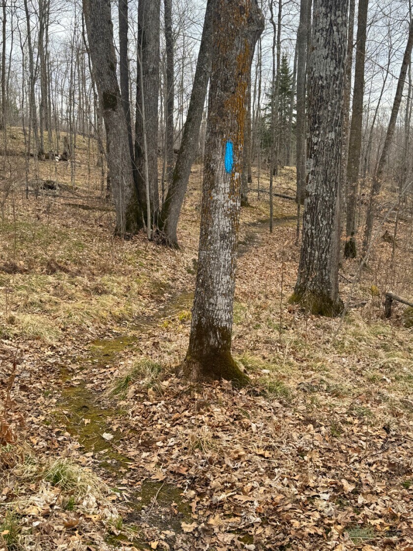
For decades, he’s maintained informal walking and cross-country ski trails on his land and neighboring county forest. In fall 2020, he set out with a compass, flagging tape and detailed paper maps.
“I can’t tell you how much I enjoyed tramping through the woods,” he said, adding that he got worryingly lost a time or two. Over a couple years, he cobbled together a route and convinced the state’s trail coordinator to come see it.
Matt Davis, based in Detroit Lakes, Minnesota, works with the nonprofit North Country Trail Association as the coordinator for North Dakota, Minnesota and Wisconsin. Davis told Johnson it’d be a tough sell to get the National Park Service to change the route.
ADVERTISEMENT
The origin of The Big Gap stems from the 2019 redirecting of the trail into the Arrowhead region and away from 75 miles of bog between Grand Rapids and Duluth, the crossing of which would have required building Guinness World Records-worthy boardwalks through aptly named Floodwood. The Arrowhead Reroute accessed a wealth of existing trail and what is arguably the state’s most scenic corner, but had required years of dogged work and an act of Congress.

In other words, changing routes cannot be done on the fly, but, because of Johnson’s persistence, Davis eventually drove to Bovey. In unorganized territory north of town, Johnson led Davis on a stroll along the West Fork of the Prairie River, into what he calls “a church of trees.” They hiked under towering red and white pines that so far have avoided being logged because of their proximity to the river.
Johnson named the two largest pines. Using a species-specific formula for aging trees from the Department of Natural Resources, he calls a red pine with a 9-foot circumference "Andrew Jackson" because it’s about 189 years old and therefore sprouted during Jackson’s presidency. The 11-foot circumference "James Madison" white pine is even older, dating back 211 years to 1814.

Davis stared into the pines and admired the river and decided to propose Johnson’s route to the National Park Service. “I’ve always looked at the trail as connecting pearls, and this is a pearl,” Davis said. In April, the Park Service approved Johnson’s route.
“He found a gem,” Davis said. "Just a perfect spot for a hiking trail.”
After The Big Gap originated as a side effect of the 2019 reroute, the North Country Trail Association’s all-volunteer, Grand Rapids-based Arrowhead Chapter began making tread. Last summer, 2.5 miles of new trail opened in Cohasset, the first of what will eventually be an 18-mile stretch that gets the NCT off roads and into the woods between the Chippewa National Forest and Grand Rapids. Until a woods path is developed northeast from Grand Rapids, hung on Johnson’s trail, the route will follow the paved Mesabi Trail to Ely.
The new piece of NCT leaves Tioga Beach on Pokegama Lake and climbs under oaks a hill inhabited by miniature eastern leatherwood trees. Natural bonsais at only a few feet tall but with the shape of a mature shade tree, the understory leatherwoods are already flowering with tubular yellow blooms.
ADVERTISEMENT
The trail crests the hill atop a 150-foot-high bluff over the water-filled Steely clouds have won the day, and the drably lighted April forest stands in odd contrast with the Caribbean-blue water in the pit.
Atop grown-over mining spoil where ore was once processed, and down to a pond rimmed in cattails and occupied by raucous red-winged blackbirds, the trail crosses a road under the watch of a broad-winged hawk, back for spring and crying atop a tall aspen.
On the other side, the rolling maple forest looks primeval, but the topography was created by mining less than a century before. Spring peepers chant unseen from an ephemeral pond in the lee of the hill. The late afternoon grows quiet until the trail bypasses a pond filled with furious ducks.

The pretty pond looks natural, but was created as a settling pond for mining runoff. The trail spits out onto True Road and continues into the forest on the other side.
Near here in 2022, a long-distance hiker crossed paths with a volunteer trail crew and spontaneously pitched in. Later that year, Aaron Landon became the 13th person to thru-hike the NCT.
“I came into Grand Rapids and spent the weekend with the trail crew learning what is involved with making a National Scenic Trail,” he recalled. “I didn’t realize the amount of work, hours and labor that went into it.”
From March to December, Landon spent 252 days walking the 4,800 miles. He was taken by the region and moved to Ely in 2023. Now, he’s volunteering on the other side of The Big Gap, blazing fresh trail between town and his home on Snowbank Lake.
ADVERTISEMENT
Johnson is excited about his trail’s inclusion into the NCT.
“I’ve gone into this thinking I might not be around to see the development happen, but am satisfied that I’m contributing,” he said. Then he hopped over a wet spot beneath a steep hill and walked along the river.
If you go
- What: Help Grand Rapids-based Arrowhead Chapter volunteers close the North Country Trail's "Big Gap"
- When: 9 a.m. May 16-18
- Where: Tioga Beach parking lot,
- Details: Bring work clothes, work gloves, sturdy footwear, trail lunch, plenty of water; safety equipment, tools, instruction provided.
- More info: arw@northcountrytrail.org,


